Colne Engaine Walk
- BigAL

- May 15, 2016
- 4 min read
Updated: May 28, 2019
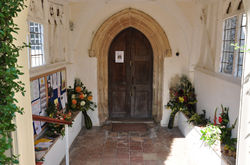
Colne Engaine gets its name Colne from the River Colne and Engaine from the family who were the main 13th century landlords. Colne Engaine is approached by five roads, centering on the green and the hilltop church of St Andrew which has stood over 900 years as a prominent landmark over the Colne Valley. The church with its attractive brick Tudor tower was sympathetically restored in the 19th century.We booted up and left the car park where there is a good play area with swings etc for children looking out over the valley.
Details of Walk

Date of Walk: 15/05/2016
Distance: 5.73 Miles
Starting Point Postcode: CO6 2EY
Car Park: Car park next to church (Free parking)
Refreshments: The Kings Head Pebmarsh & Five Bells Colne Engaine
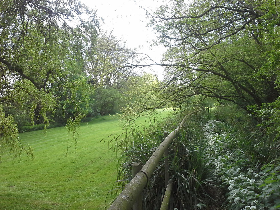
From here we entered the church yard and walked round the church leaving by the lychgate into Church Street going pass the village shop up to the green where we crossed to a footpath sign. This path led us down to a field where we followed the track down to a road where we turned left and about 1/2 a mile we passed Nightingale Farm on the right and just round a left hand bend just pass Nightingale Cottages we turned right over a style and continued along a fenced path round the back off a garden. We crossed over a field which had rape growing and was about shoulder height to a bridge. In the next field we kept to the right hand edge of the field and then descended on a track through a strip of woodland and then swung right to join a cross track where we turned left to follow this track up between trees and bushes.

At the top at a major junction of tracks we went right through a grassy gap and then we walked diagonally across the field to a bridge which we crossed and turned left on to a rather boggy slice of the woodland till we came to a lane.We turned right on to Water Lane to follow the road down hill into Pebmarsh with the Kings Head in front of us, here we decided to make use of a bench by the village sign to have a pit stop. From here we turned right and walked to St John the Baptist church and opposite is Mill Lane which we had to take after walking about 200 yards we forked left off the lane on to a track going past a thatched house and then crossed over a style into a woodland.
The field that run along the side of the woodland path had sheep grazing and we were glad they had a fence as Rudy was interested in the sheep so we had to keep a eye on him especially there were gaps at the bottom of the fence and also his nose was interested in badgers excavations to. At the end of the wood we crossed a bridge the walked along the side of a reservoir that had ducks and geese on it and there were people fishing. At the end of the wide track alongside the reservoir there is a dam we went down the side of it and followed the path alongside a woodland an then into a field and followed it along the right hand field edge and we done the same in the next field passing a ford across the stream and then we crossed over a bridge and followed a fenced path round a willow plantation with a good view of Brompton's a restored private house until we reached a road where we turned left.

At the next concrete finger post on the right we entered a meadow through a kissing gate, the grass was quite high but there was tyre tracks that we could follow but it was not easy going as we were walking over long grass that had only been flattened by a vehicle. At the end of the meadow we left it across a earth bridge
which was soon followed by a style and another bridge into a field and followed it along the right hand field edge and we done the same in the next field passing a ford across the stream and then we crossed over a bridge turning left along a brook with a pond on the left which was at the bottom of someone's garden and then we turned left on a track to a road.
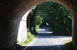
We turned right and on the corner and then turned left to walk along a left field edge through a strip of woodland and then up some steps and turned right on to a tracked of a disused railway. At the next junction we turned right down the slope and then bared left to pass a weir with the golf course on the opposite of the River Colne. At the field boundary we turned right and followed the power poles and when up the top we went left and continued to a corner where we turned right which brought us to a field edge. We carried straight on along side the road which we joined when it came to a sharp right. At the bottom of the road we came to The Five Bells and decided to stop and have a shandy before entering the church yard to go back to the car park.


Comments