Saffron Walden Walk
- BigAL

- Aug 28, 2017
- 3 min read
Updated: Jul 27, 2019
Saffron Walden is a market town in the Uttlesford district of Essex, England. It is 12 miles north of Bishop's Stortford, 18 miles south of Cambridge.The town retains a rural appearance and some buildings dating from the medieval period.The walk well apart from parking near the town and a walk along one or two of the streets it was more to do with Audley End Park, the walk was supposed to be 3.5 miles long but we or should I say I went wrong and ended up being more like 5.5 miles long.
Details of Walk

Date of Walk: 28/08/2017
Distance: 3.88 Miles
Car Park: Swan Meadow Free on Sundays CM22 7EB
Refreshments: Plenty of nice pubs and tea rooms in Saffron Waldon
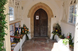
The walk started from Swan meadow car park and we walked along the service road to some bollards and carried straight on until there was a finger-post signed to the Salvation Army. We turned here and went under the arch between the almshouses and to the lane by the United reformed church where we turned right and continued down to the gates of Audley End Park.

Here we should have taken the middle of the three paths on the right but we got it wrong and ended up taking going straight on but we managed to meet up with the path we should have been on later after getting some help from a dog walker which we followed over a stream where we had to cross by stepping on stones.
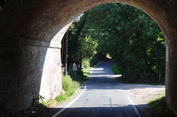
We eventually was on the right path going under a bridge and the stream on the right and a wall on the left which brought us out to a drive where we turned left still following the estate wall and over another bridge from here you could see over the wall into the estate where there was people walking round.

We followed the drive up to the main road and turned left and past a gatehouse leading into the stables and then on to one of the iconic views of Essex Audley End House and lake and over to the left were the stables. When we reached the junction we turned left we took us over a bridge and just over it there was a sloping verge and here we decided to have our lunch sitting there admiring the view of the house and lake. After we had our lunch we carried on past the children's railway on the right and the main entrance to the house.

Just past this we turned right at the end house at a white finger-post and down hill on the only street in Audley End with its pretty terraces were once originally almshouses. Just over the bridge at the bottom we forked left and followed the drive which passed in front of a farm buildings to reach the road.We crossed here and turned left and carried on up a hill but this is where we turned right when we should not have done and walked round the edge of the school grounds until we came out onto a housing estate. After realising that we had gone wrong we had to retrace our steps back and once back we turned right and walked to the junction where we turned left again and walked by the wall to go through a gate on the right.

Once through the gate we carried straight forward crossing a wide track that was used to exit Audley End car park and it was just a matter of walking in a straight line until we got to the gate which we originally entered the park. We went through the gate and walked about 80 yards then turned right on a raised path alongside an old wall. Near the top of the rise we turned left by a way-marker post and at the road we went left to the bottom and continuing to the left of the United Reformed church. and after going through the arch again we went straight across the lane through another arch. We forked right and walked up through a small car park and through Myddylton Place, passing the youth hostel which is one of the finest medieval buildings in the town and then we turned left along Bridge Steet. Taking the next left along Freshwell Street and continuing past some bollards at the end we went right at the pond, then forked right at the bridge to return to the start at the car park.


Comments