Clacton on Sea Walk
- BigAL

- Oct 4, 2015
- 6 min read
Updated: May 28, 2019
This walk is the longest one we have ever done 12.5 miles long, although it is called Clacton walk this is mainly the starting point which is the Martello Tower end of Clacton. The walk takes you past Jaywick along the sea wall then in land to St Osyth and then back to Clacton via Clacton airfield.and this is the first made up walk we have done, Christine said she fancied a walk by the coast so just before we left I done a quick route on Bing Maps and saved it to onedrive and downloaded on to Christine phone.
Details of Walk

Date of Walk: 04/10/2015
Distance: 12.42 Miles
Level of Difficulty: A Fairly Easy Walk
Car Park: Car Park by the Martello Tower and street parking but need to get there early CO15 1XY
Refreshments: Cafe on seafront by the Lifeguard Hut to name just one in clacton also there is a cafe at Seawick near the sea wall
I did not take to much notice of the length but thought it was about 9 miles long. We did not leave to early as I had woke up with a bit of a head, so we got there about 10:45 and went straight to our usual cafe to have a cooked breakfast before we started the walk. The cafe is called Greensward Cafe and we have had many good times sitting outside looking out to sea having a breakfast.

It was just ourselves and of course Honey & Rudy we finished our breakfast about 11:30 and set off on our way heading right towards Jaywick along the sea wall. We passed the Lifeguard Post, Toby Carvery, the slipway where jet skis get taken down to the sea and of cause the royal lifeboat station which uses the slipway as well as the boat they use has to be taken down to the sea by tractor. You almost straight away go pass the first of three Martello Towers along the walk and as of yet we had not decided to do the whole walk or just walk along the sea wall and it was not until we passed Jaywick that we decided to go the whole way. Keeping on the sea wall and passing another Martello Tower until we got to Jaywick which we have walked up to many a times and it has not changed pretty run down which is a shame as it could look really nice, I believe a sum of money has been given to make improvements so in time who knows. It is very interesting walking pass all the different style homes as you walk along the see wall through Jaywick some run down and boarded up and some are really looked after. We see one that was for sale which needed work done to it, I took the number and looked it up when we got home and it was up for sale at £120,000. When we got to the next Martello Tower we had reached the end of Jaywick and walking towards Seawick and here we decided to have a pit stop, a mug of tea and a Kitcat and the use of the toilets which had a sign up saying if you can not afford a tea you can not have a wee.

After leaving here we carried along the sea wall passing by St Osyth beach and still on the seawall with the sea on one side and St Osyth Marsh on the right, we then arrived at Lee over Sands which comprises of a few buildings and there is a few on the actual beach. From here you could have taken the shorter route down a road but we decided to carry on along the sea wall which bent round Colne Point to the right. When reaching the sewage works you come down off the sea wall via steps but do not turn right and left round the field walk straight across it to the road where you cross the rd to follow the footpath as this is where we went wrong and we had the river on our left and it should have been on the right. We carried on across St Osyth marsh and came to a road after passing a beehive where there was a man with the full bee suit on and saying it would be alright to come by as the bees were coming in from a different direction but we did have a few bees buzzing around us.
Well when we reached the road we were not sure which way to go as we were believing we were at this other road well we settled on turning right along the road we passed Lee Wick Farm and then worked out exactly where we we on the map. we continued along the road which had two sharp left and right bends until we reached the main road between St Osyth and Point Clear. We turned right here and followed the road into St Osyth before you get to the main town we crossed a bridge with St Osyth Creek on the left with boats seating in the mud as the tide was not in and to the right was the privately owned Mill Dam Lake which was man made with sluice gates that could let water in or out of the lake.Once over the bridge we turned right along the bank of the lake just for a little while and then turned left and headed uphill to the recreation ground and from here we could now see in the distance the priory unfortunately it had scaffolding round it which meant not getting a good photo.
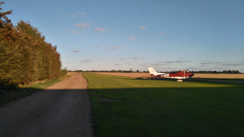
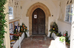
By now we were getting thirsty and hungry so we found a shop which was just past St Peter & St Paul's Church and bought some water and breakfast choc bars to keep us going for the rest of the walk. From the shop we headed down Spring Lane which then continues into Beach Road, on the left there was a recently build house that just looked great, it had all the charm of a old house with the modern day touches, just past this house before the road starts going uphill we turned left into Dalters Lane and we followed this for some way until there was a sharp bend to the right. Here we carried straight on down the lane that leads to St Osyth Lodge Farm and the field on the left was very flat and had not long been sown very long ago as small seedlings looked very fine and we reckoned it was a field of grass been sown for turf and our guess was right as later on we saw loads of fields looking like massive lawns. When reaching the farm we surprised to see a grass airstrip with a light aircraft on it and two more in a open fronted hanger. We walked along the drive alongside the airstrip to the road then turned right about a 100 yards on the right there was a waymark which pointed straight across the lawn or should I say field and we wondered if any one took this route as it looked to good to walk over.

The sun was getting very low and we did half think of waiting till it went down as it would have made a good photo but time was pressing on and we still had a way to go. We carried along the road until Clacton 22we came to a sharp right hand bend which we went round and then there was a footpath on the left which took us along the edge of a field bringing us to Sacketts Grove Holiday Park. We walked through the park to bring us out on to Jaywick Lane where we turned right and walked along the road till we came to a lane on the left by Millers Barn Golf Course. This Lane called Alton Park Lane had the golf course to the left and lakes to the right which was once a quarry years ago I expect. At the end of the lane we came to a sign which we have not seen on any of our walks before telling us to lookout before we cross for planes landing as we had to cross Clactons Airfield. Well after looking each way we crossed and there was no aircraft to be seen and once across we had just a little way to walk before coming out on to Cherry Tree Avenue, we were now on the outskirts of Clacton and it was just a matter of walking down the road and cutting through a housing estate to bring us back to the sea front and a few steps more and we were back to the car


Comments